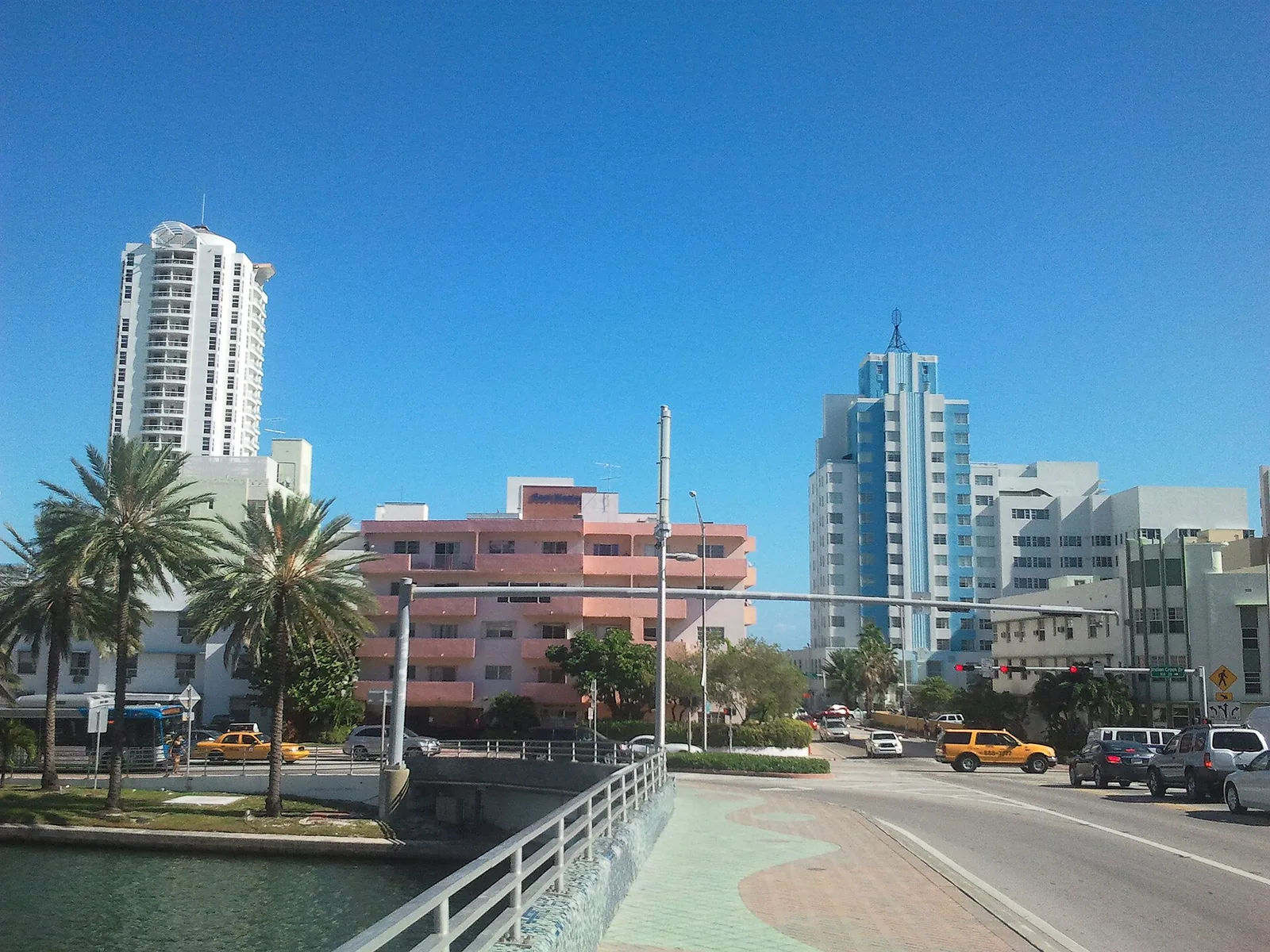
Miami Beach's neighborhoods from South of Fifth to North Beach: ZIP codes, zoned schools, Zillow home values and how many homes each area holds.
Last checked Oct. 9, 2026. Sources: the City of Miami Beach neighborhood association list, neighborhoods map and 2050 Comprehensive Plan, Miami-Dade County’s open data (municipal boundaries, address points and school attendance boundaries), the Florida Department of Education’s 2026 school grades, Zillow Research, the Census Bureau’s American Community Survey and OpenStreetMap.
Miami Beach is a barrier island and a string of islands in Biscayne Bay, about 7.5 miles from Government Cut at its southern tip to the Surfside line at 87th Terrace. The city’s 2050 Comprehensive Plan, adopted May 20, 2026, speaks of three sections: South Beach, Middle Beach and North Beach. Inside them, residents organize by smaller areas, and the city’s list of neighborhood associations gives the street boundaries this guide uses.
The Census Bureau’s American Community Survey for 2020 to 2024 counts 82,031 residents, a median household income of $72,856 and a median value of owner-occupied homes of $556,700 (QuickFacts).
What this means for you
- High school: every address is zoned to Miami Beach Senior High, rated B in Florida’s 2026 grades; every address is zoned to Nautilus Middle (A) for middle school.
- Home values: $464,044 in ZIP 33139, $684,957 in 33140 and $422,963 in 33141 in August 2026, according to the Zillow Home Value Index.
- Interstates: I-395 starts at Alton Road and Fifth Street (MacArthur Causeway) and I-195 at Alton Road and 41st Street (Julia Tuttle Causeway).
How the city is laid out
- ZIP codes: 33139 covers South Beach, 33140 Mid-Beach and 33141 North Beach and Normandy Isles. Fisher Island, ZIP 33109, is outside the city limits on Miami-Dade County’s municipal boundary map.
- Main roads: Collins Avenue (State Road A1A) runs the length of the oceanfront and Alton Road the bay side. Four causeways cross the bay: the MacArthur (I-395), the Venetian, the Julia Tuttle (I-195) and the 79th Street Causeway.
- Condos and houses: Miami-Dade County’s address data lists 10,730 street addresses in the city and 77,469 when condo units are counted one by one. More than a quarter of those units are on the Mid-Beach oceanfront.
- School zones do not follow neighborhood lines. The elementary lines cross Flamingo Park, West Avenue, Collins Park and Sunset Harbor, and Normandy Isles is zoned to Treasure Island Elementary in North Bay Village. Check any address with the district’s School Locator; more in our schools guide.
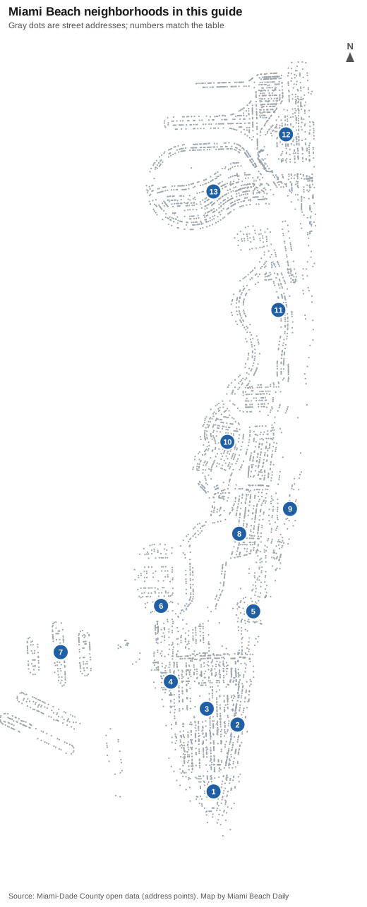
Every area at a glance
| # | Area | ZIP | Zoned elementary (2026 grade) | Zoned high school | Typical home value in its ZIP, Aug. 2026 | Addresses with condo units |
|---|---|---|---|---|---|---|
| 1 | South of Fifth | 33139 | South Pointe (A) | Miami Beach Senior High | $464,044 | 6,384 |
| 2 | Art Deco District | 33139 | Feinberg/Fisher K-8 (C), South Pointe (A) | Miami Beach Senior High | $464,044 | 2,199 |
| 3 | Flamingo Park | 33139 | Feinberg/Fisher K-8 (C), South Pointe (A) | Miami Beach Senior High | $464,044 | 7,327 |
| 4 | West Avenue | 33139 | Feinberg/Fisher K-8 (C), South Pointe (A) | Miami Beach Senior High | $464,044 | 5,667 |
| 5 | Collins Park | 33139, 33140 | North Beach (A), Feinberg/Fisher K-8 (C) | Miami Beach Senior High | $464,044 | 4,612 |
| 6 | Sunset Harbor | 33139 | North Beach (A) | Miami Beach Senior High | $464,044 | 3,608 |
| 7 | Venetian Islands | 33139 | North Beach (A) | Miami Beach Senior High | $464,044 | 2,337 |
| 8 | Bayshore | 33140 | North Beach (A) | Miami Beach Senior High | $684,957 | 786 |
| 9 | Mid-Beach oceanfront | 33140 | North Beach (A) | Miami Beach Senior High | $684,957 | 20,800 |
| 10 | Nautilus | 33140 | North Beach (A) | Miami Beach Senior High | $684,957 | 463 |
| 11 | La Gorce | 33140, 33141 | North Beach (A) | Miami Beach Senior High | $684,957 | 459 |
| 12 | North Beach | 33141 | Biscayne Beach (A) | Miami Beach Senior High | $422,963 | 14,157 |
| 13 | Normandy Isles | 33141 | Treasure Island (C) | Miami Beach Senior High | $422,963 | 3,042 |
Where an area has two ZIP codes, the value shown is for the one most of its addresses use. The Zillow Home Value Index is a modeled typical value for the middle third of homes, single-family homes and condos together, not a sale price. More in our home prices guide and property taxes guide.
South Beach
South of Fifth is the tip of the island below Fifth Street, condo towers around South Pointe Park, with its own A-rated elementary school. The Art Deco District, Fifth to 15th streets between Ocean Drive and Washington Avenue, is mostly hotels; our visitor guide covers it. Flamingo Park, Fifth Street to Lincoln Road between Alton Road and Washington Avenue, holds 7,327 addresses counting condo units, mostly inside the Flamingo Park Historic District. West Avenue is the bayfront strip west of Alton Road, with a city overlay district and the planned Bay Walk. Collins Park runs from 17th to 25th streets on the ocean, around the Bass Museum.
The bay islands and Sunset Harbor
Sunset Harbor is the pocket north of Dade Boulevard, with the four single-family Sunset Islands and the small Palm View neighborhood. The Venetian Islands in Miami Beach are Belle Isle, Rivo Alto, Di Lido and San Marino on the Venetian Causeway. Palm, Hibiscus and Star islands, off the MacArthur Causeway, hold about 350 addresses and have their own association on the city’s list; we have not given them a page.
Mid-Beach
Bayshore, from Dade Boulevard to 40th Street between Alton Road and Pine Tree Drive, is mainly houses, with Miami Beach Senior High and the city golf club. The Mid-Beach oceanfront, Collins Avenue from 23rd to 63rd streets, holds 20,800 addresses counting condo units, more than a quarter of the city’s. Nautilus, 42nd to West 48th streets, has Nautilus Middle inside it, and La Gorce covers La Gorce and Pine Tree drives from 51st to 63rd streets and La Gorce Island. North Bay Road, Lakeview and the Alton Road corridor have their own associations on the city’s list but no page here.
North Beach
North Beach runs from 63rd Street to the Surfside line and includes the Town Center north of 71st Street, the North Shore Historic District and the Biscayne Point islands. Normandy Isles, Normandy Isle and Normandy Shores, sits in the bay to the west on 71st Street.
Comparing Miami Beach with its neighbors
Taxes, schools, home values and commutes for Miami Beach, North Bay Village, Miami Shores and Miami, side by side: Miami Beach vs North Bay Village vs Miami Shores vs Miami. Moving here? See moving to Miami Beach and getting around.
How we built this
The areas come from the City of Miami Beach’s own sources: the street boundaries each neighborhood association gives on the city’s list, the areas drawn on the city’s neighborhoods map, the historic districts layer and the 2050 Comprehensive Plan’s South, Middle and North Beach sections and West Avenue and North Beach Town Center designations. We checked them against OpenStreetMap place names and island outlines. We left out areas we could not place on a map from a source, and we did not name subdivisions the city does not name. Address counts, ZIP codes and school zones come from Miami-Dade County’s address points matched to the county’s elementary, middle and high school attendance boundary layers (updated in September 2026) on Oct. 9, 2026; about 7% of the city’s addresses, mostly in the Alton Road and North Bay Road corridor and around City Hall, fall between the areas on this page. Map data: Miami-Dade County; store, park and island data © OpenStreetMap contributors.
Frequently asked questions
What are the main neighborhoods in Miami Beach?
The city’s comprehensive plan divides Miami Beach into South Beach, Middle Beach and North Beach. Within them, the city’s neighborhood association list names areas such as South of Fifth, Flamingo Park, West Avenue, Collins Park, Sunset Harbor, the Venetian Islands, Bayshore, Nautilus, La Gorce, North Beach and Normandy Isles.
What are the ZIP codes in Miami Beach?
33139 covers South Beach, 33140 Mid-Beach and 33141 North Beach and Normandy Isles. Zillow put the typical home value at $464,044 in 33139, $684,957 in 33140 and $422,963 in 33141 in August 2026.
What high school is Miami Beach zoned for?
Every address in the city is zoned to Miami Beach Senior High, 2231 Prairie Ave., on Miami-Dade County’s attendance boundary layer. It earned a B in Florida’s 2026 school grades.
Do Miami Beach school zones follow neighborhood lines?
No. The elementary zone lines cross Flamingo Park, West Avenue, Collins Park and Sunset Harbor, and Normandy Isles is zoned to Treasure Island Elementary in North Bay Village. Check an address with the district’s School Locator.
Have your say