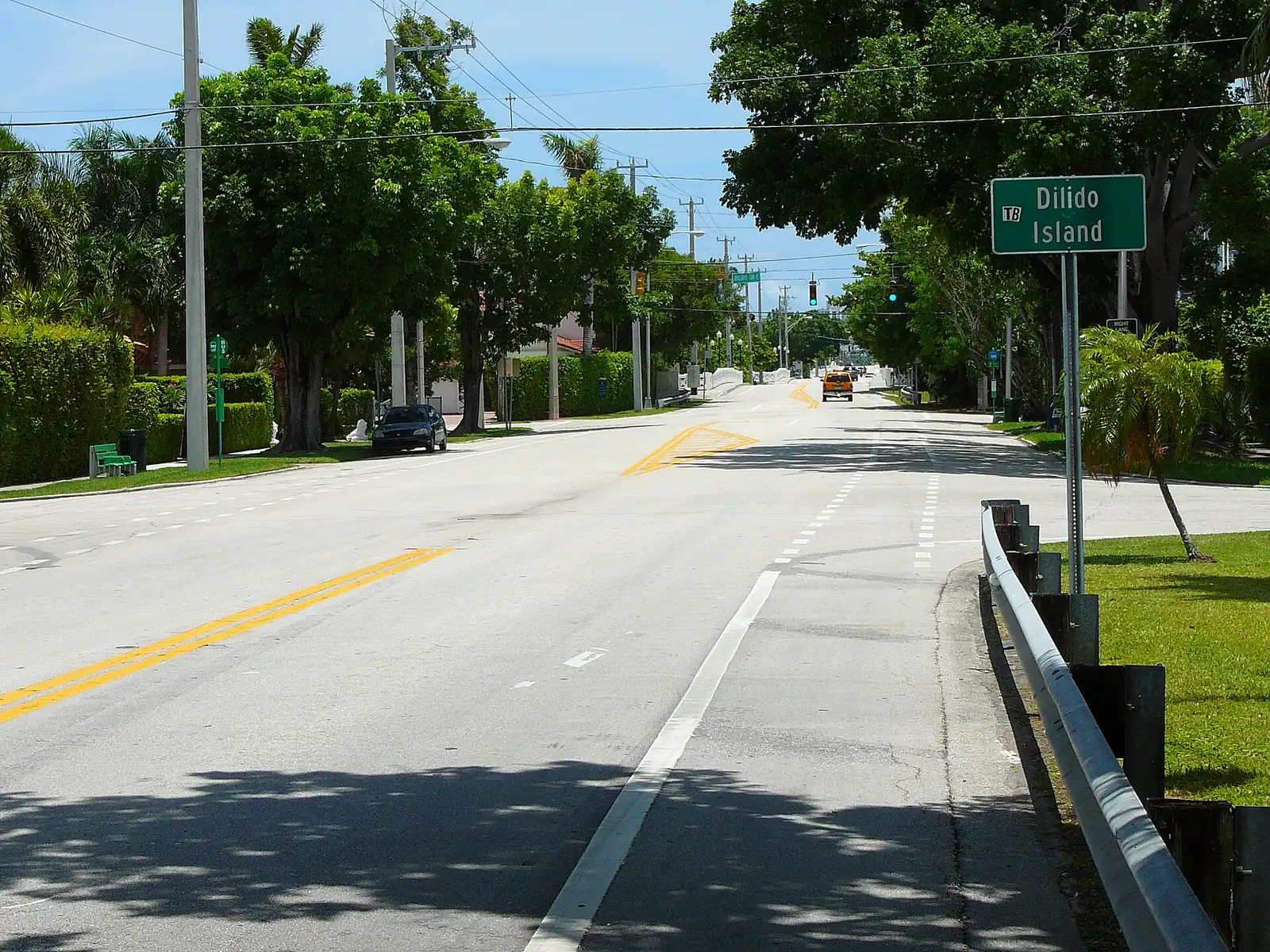
Miami Beach's Venetian Islands are Belle Isle, Rivo Alto, Di Lido and San Marino, all in ZIP 33139, with 2,337 addresses counting condo units.
Last checked Oct. 9, 2026. Sources: the City of Miami Beach neighborhood association list, neighborhoods map and parks directory, Miami-Dade County’s open data (municipal boundaries, address points and school attendance boundaries), the Florida Department of Education’s 2026 school grades, Zillow Research, Miami-Dade Transit and OpenStreetMap.
The Venetian Islands are the chain of man-made islands strung along the Venetian Causeway across Biscayne Bay. Four of them are in Miami Beach: Belle Isle, closest to the beach, then Rivo Alto, Di Lido and San Marino. Biscayne and San Marco islands, farther west, are in the City of Miami on Miami-Dade County’s municipal boundary map. The city’s neighborhoods map shows Belle Isle and the Venetian Islands as two areas; this page covers both.
The county’s address data shows two different kinds of island. Rivo Alto (109 addresses), Di Lido (167) and San Marino (90) are single-family homes. Belle Isle has 33 street addresses but 1,971 condo units, most of them in towers. In all, 399 street addresses and 2,337 addresses counting condo units, about 3% of the city’s total.
What this means for you
- High school: Miami Beach Senior High, rated B in Florida’s 2026 school grades.
- Home value: $464,044 in ZIP 33139 in August 2026, according to the Zillow Home Value Index.
- Nearest interstate: the start of I-395 (MacArthur Causeway) at Alton Road and Fifth Street, about 2.3 miles by road; I-195 is about 2.5 miles.
Part of our Miami Beach neighborhoods guide.
Where it is
The Venetian Causeway (Venetian Way on the islands) is the road on and off. It runs west from Dade Boulevard in Miami Beach across Belle Isle and the three residential islands, then on through the City of Miami islands to the mainland near downtown Miami. Most homes on each island are on a drive named for it: Rivo Alto Drive, Di Lido Drive and San Marino Drive.
ZIP code: 33139 for every address.
Schools
Miami-Dade County Public Schools assigns schools by address. Every Miami Beach address on the islands falls in these zones on the county’s attendance boundary layers:
| Level | Zoned school | Florida 2026 grade |
|---|---|---|
| Elementary | North Beach Elementary, 4100 Prairie Ave. | A |
| Middle | Nautilus Middle, 4301 N. Michigan Ave. | A |
| High | Miami Beach Senior High, 2231 Prairie Ave. | B |
Grades are from the Florida Department of Education; each name links to the school’s state report card. Check an address with the district’s School Locator. More in our schools guide.
Home values
The typical home value in ZIP 33139 was $464,044 in August 2026, up 0.04% from $463,844 in August 2025, according to the Zillow Home Value Index. The index is a modeled typical value for the middle third of homes, single-family homes and condos together, not a sale price. It covers all of 33139, which is mostly South Beach condos, so it is a poor guide to single-family homes on the islands. Zillow’s figure for Miami Beach as a whole was $522,429, up 1.0% on the year. For individual properties, the county’s property search shows assessed values and recent sales. More in our home prices guide.
Parks and trails
- Belle Isle Park, a city park on Belle Isle.
- Maurice Gibb Memorial Park, 18th Street and Purdy Avenue, just east across the water in Sunset Harbor, with the city’s free water taxi to downtown Miami.
More in our parks and trails guide.
Getting around
- Interstate: the start of I-395 (MacArthur Causeway) at Alton Road and Fifth Street, about 2.3 miles by road from the middle of the islands; the start of I-195 (Julia Tuttle Causeway) at Alton Road and 41st Street, about 2.5 miles.
- City Hall (1700 Convention Center Drive): about 1.6 miles.
- Airport: about 8.7 miles to Miami International Airport, west over the Venetian Causeway.
- These are distances measured on the OpenStreetMap road network with the OSRM routing engine, not drive times.
- Bus: Miami-Dade Transit’s current schedule data lists route 15, which runs between the Omni area of downtown Miami and Miami Beach over the Venetian Causeway, with stops on Venetian Way at each island. Times are on Metrobus.
- More in our getting around guide.
Homeowners and residents associations
The city’s list includes the Venetian Islands Homeowners Association, which represents homeowners on Rivo Alto, Di Lido and San Marino islands and the part of the causeway within them, with membership by application and $75 annual dues, and the Belle Isle Residents Association, open to Belle Isle residents. The city notes that every association on its list is an independent private organization. Belle Isle’s condo buildings have their own associations under Florida law.
Groceries and everyday stores
OpenStreetMap lists no supermarket or pharmacy on the islands. The nearest it maps are in Sunset Harbor, about a mile away in a straight line: a Publix at 1920 West Ave. and The Fresh Market at 1800 West Ave., with a Walgreens at 1845 Alton Road.
How we drew this area
This page combines the Venetian Islands and Belle Isle areas on the City of Miami Beach neighborhoods map with the OpenStreetMap outlines of the four islands, limited to addresses inside the city on Miami-Dade County’s municipal boundary layer. Address counts, ZIP codes and school zones come from the county’s address points (street addresses, and the same data with condo units counted one by one) matched to its elementary, middle and high school attendance boundary layers (updated in September 2026) on Oct. 9, 2026. Store and park locations and road distances use © OpenStreetMap contributors.
Frequently asked questions
Which Venetian Islands are in Miami Beach?
Belle Isle, Rivo Alto, Di Lido and San Marino islands are in Miami Beach. Biscayne and San Marco islands, farther west on the Venetian Causeway, are in the City of Miami on Miami-Dade County’s municipal boundary map.
What ZIP code are the Venetian Islands in Miami Beach?
- Zillow put the typical home value in 33139 at $464,044 in August 2026, but that figure covers all of South Beach and its condos, not just the islands.
What school are the Venetian Islands zoned for?
On the county’s attendance boundary layers, every Miami Beach address on the islands is zoned to North Beach Elementary (A in Florida’s 2026 grades), Nautilus Middle (A) and Miami Beach Senior High (B).
Is there a homeowners association on the Venetian Islands?
The city lists the Venetian Islands Homeowners Association for Rivo Alto, Di Lido and San Marino, which takes members by application with $75 annual dues, and the Belle Isle Residents Association. The city says both are independent private groups.
Have your say