Normandy Isle and Normandy Shores sit in the bay west of North Beach on 71st Street, all in ZIP 33141, with 3,042 addresses counting condo units.
Last checked Oct. 9, 2026. Sources: the City of Miami Beach neighborhood association list, neighborhoods map, historic districts layer and parks directory, the Miami-Dade property appraiser’s 2025 millage chart, Miami-Dade County’s open data (address points and school attendance boundaries), the Florida Department of Education’s 2026 school grades, Zillow Research, Miami-Dade Transit and OpenStreetMap.
Normandy Isles is the pair of islands in Biscayne Bay between North Beach and North Bay Village: Normandy Isle, crossed by 71st Street and Normandy Drive, and Normandy Shores to its northwest, around the city’s golf course. Both are in Miami Beach and both are on the city’s neighborhoods map. Miami-Dade County’s address data puts 1,387 street addresses and 3,042 addresses counting condo units on the two islands, about 4% of the city’s total, a mix of apartment and condo buildings and single-family homes.
What this means for you
- High school: Miami Beach Senior High, rated B in Florida’s 2026 school grades.
- Home value: $422,963 in ZIP 33141 in August 2026, according to the Zillow Home Value Index.
- Nearest interstate: the start of I-195 (Julia Tuttle Causeway) at Alton Road and 41st Street, about 4.7 miles by road; the 79th Street Causeway, west through North Bay Village, also leads to the mainland.
Part of our Miami Beach neighborhoods guide.
Where it is
Many street names on Normandy Isle are French: Rue Granville, Rue Versailles, Rue Notre Dame, Rue Bordeaux, Biarritz Drive, Trouville Esplanade and Brest Esplanade. The groups on the city’s association list divide the islands like this:
- Normandie Sud: Rue Granville to Rue Versailles south of 71st Street, including Biarritz Drive, Bay Drive, Trouville Esplanade, Rue Bordeaux and Rue Notre Dame.
- Normandy Center: single-family homes on 71st Street and Normandy Drive from Rue Granville to Rue Notre Dame.
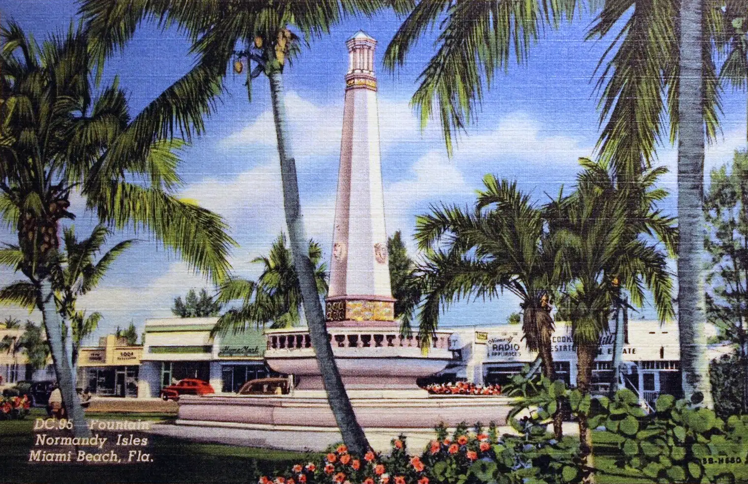
- Normandy Fountain: south of 71st Street and Normandy Drive from Rue Notre Dame to Bay Drive, including Biarritz Drive and Brest Esplanade east of Rue Notre Dame.
- Normandy North: single-family homes along Marseille Drive, Calais Drive, 71st Street and Normandy Drive.
- Normandy Shores: North Shore Drive, South Shore Drive and Fairway Drive.
The city’s historic districts layer shows two pieces of the Normandy Isles Historic District on Normandy Isle, covering about 9% of the islands’ street addresses.
ZIP code: 33141 for every address.
Schools
Miami-Dade County Public Schools assigns schools by address. Every address on both islands falls in these zones on the county’s attendance boundary layers:
| Level | Zoned school | Florida 2026 grade |
|---|---|---|
| Elementary | Treasure Island Elementary, 7540 E. Treasure Drive, North Bay Village | C |
| Middle | Nautilus Middle, 4301 N. Michigan Ave. | A |
| High | Miami Beach Senior High, 2231 Prairie Ave. | B |
Treasure Island Elementary is in neighboring North Bay Village. Grades are from the Florida Department of Education; each name links to the school’s state report card. Check an address with the district’s School Locator. More in our schools guide.
Home values
The typical home value in ZIP 33141 was $422,963 in August 2026, up 0.2% from $421,992 in August 2025, according to the Zillow Home Value Index. The index is a modeled typical value for the middle third of homes, single-family homes and condos together, not a sale price, and it covers all of 33141, including North Beach. Zillow’s figure for Miami Beach as a whole was $522,429, up 1.0% on the year. More in our home prices guide.
Normandy Shores properties pay an extra 0.7305 mill for their own district on the Miami-Dade property appraiser’s 2025 millage chart, for a 2025 total of 19.4906 mills against 18.7601 in most of the city. More in our property taxes guide.
Parks and trails
From the city’s parks directory:
- Normandy Isle Park and its pool, at 7030 Trouville Esplanade on OpenStreetMap.
- Normandy Shores Golf Club, 2401 Biarritz Drive.
- Normandy Shores Park and Tennis Courts, 2600 Biarritz Drive.
- Fairway Park, 200 Fairway Drive.
More in our parks and trails guide.
Getting around
- Interstate: the start of I-195 (Julia Tuttle Causeway) at Alton Road and 41st Street, about 4.7 miles by road from the middle of the area; the start of I-395 (MacArthur Causeway) at Alton Road and Fifth Street, about 7.1 miles.
- City Hall (1700 Convention Center Drive): about 5.7 miles.
- Airport: about 12.8 miles to Miami International Airport.
- These are distances measured on the OpenStreetMap road network with the OSRM routing engine, not drive times.
- Bus: Miami-Dade Transit’s current schedule data lists routes 79 and 279 on 71st Street and route 279 on Normandy Drive. Route 79 continues west over the 79th Street Causeway. Times are on Metrobus.
- More in our getting around guide.
Homeowners and neighborhood associations
The city’s list shows Normandie Sud, Normandy Center and Normandy Fountain as voluntary, the first two with a $25 membership fee, and Normandy North and Normandy Shores as open to people who live in their areas, with voluntary membership. The city notes that every association on its list is an independent private organization. Condo buildings have their own associations under Florida law.
Groceries and everyday stores
From OpenStreetMap: Tropical Supermarket at 969 Normandy Drive, Bay Supermarket at 905 Bay Drive and a Walgreens at 2000 Normandy Drive. The Publix at 6876 Collins Ave. is in North Beach, about a mile east in a straight line.
How we drew this area
This page uses the OpenStreetMap outlines of Normandy Isle and Normandy Shores and the Normandie Sud and Normandy Shores areas on the City of Miami Beach neighborhoods map, checked against the association areas on the city’s list. Address counts, ZIP codes and school zones come from Miami-Dade County’s address points (street addresses, and the same data with condo units counted one by one) matched to the county’s elementary, middle and high school attendance boundary layers (updated in September 2026) on Oct. 9, 2026. Store and park locations and road distances use © OpenStreetMap contributors.
Frequently asked questions
Where is Normandy Isles in Miami Beach?
Normandy Isle and Normandy Shores are islands in Biscayne Bay west of North Beach, reached on 71st Street and Normandy Drive. The city’s association list divides them into areas such as Normandie Sud, Normandy Fountain, Normandy North and Normandy Shores.
What school is Normandy Isles zoned for?
On the county’s attendance boundary layers, every address is zoned to Treasure Island Elementary in North Bay Village (C in Florida’s 2026 grades), then Nautilus Middle (A) and Miami Beach Senior High (B).
What ZIP code is Normandy Isles, Miami Beach?
- Zillow put the typical home value in 33141 at $422,963 in August 2026, up 0.2% from August 2025.
Do Normandy Shores homes pay an extra property tax?
Yes. The Miami-Dade property appraiser’s 2025 millage chart adds 0.7305 mill for the Normandy Shores district, for a total of 19.4906 mills against 18.7601 in most of Miami Beach.
Have your say