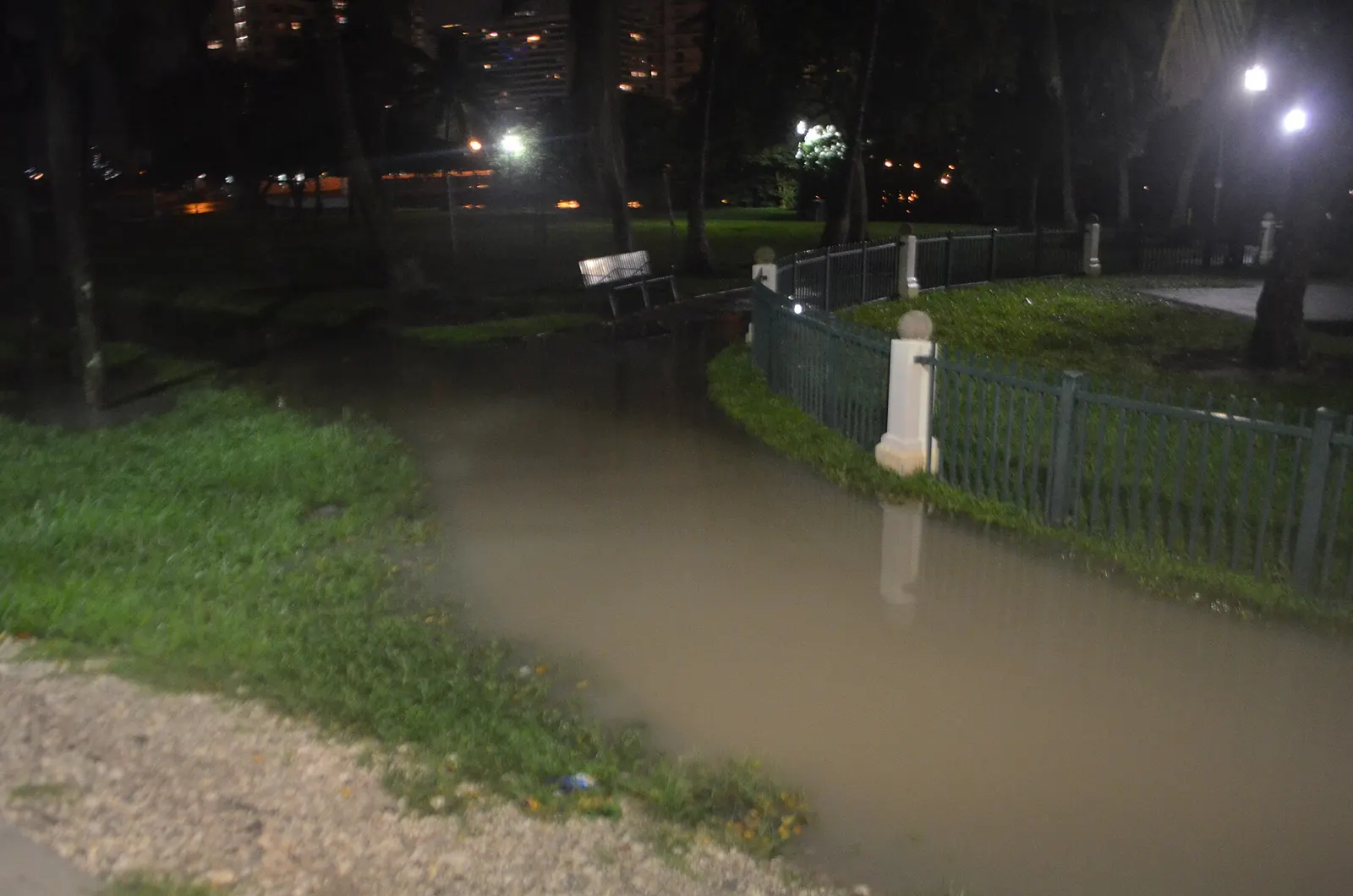
The next king tides hit Miami Beach Nov. 6-9, peaking near 8 a.m. Nov. 8, then Nov. 23-26. Peak times for both windows, free garage parking and what to do.
The next king tide window in Miami Beach runs from Friday, Nov. 6, to Monday, Nov. 9. The last of the season follows Nov. 23-26, over Thanksgiving. The first window ended Oct. 30, after the water at Virginia Key passed major flood stage.
Updated Nov. 1: Added NOAA’s peak tide times for both November windows. The weather service’s coastal flood advisory now runs to 7 p.m. Monday, Nov. 2, with a flood watch for heavy rain; see our flood story. The city’s king tides page could not be reached Sunday, so the November dates are as it last listed them.
Updated Oct. 31, evening: The October window has ended, but the weather service has extended its coastal flood advisory to 7 p.m. Sunday, Nov. 1. Water at Virginia Key was still about 1.3 to 1.5 feet above the tables Saturday. Sunday’s afternoon high tide is at 2:04 p.m. Details in our flood story.
Updated Oct. 28: The tide at Virginia Key reached 2.54 feet Tuesday, past the 2.5-foot major flood stage, and 2.51 feet Wednesday. The weather service’s coastal flood warning ended at 8 p.m. Wednesday, and a coastal flood advisory runs until 8 p.m. Thursday. Readings in our flood story.
Updated Oct. 25: The National Weather Service in Miami issued a coastal flood warning from 2 a.m. Monday to 8 p.m. Tuesday and expects major flood stage on both days. Water at Virginia Key has run about 1.5 feet above the tide tables since Thursday. The city now dates this window from Oct. 22. Details in our flood warning story.
The dates come from the city’s king tides page, which uses NOAA’s tide tables for the Virginia Key gauge. The city checks those predictions against its own street elevation data to judge when low-lying areas may flood.
Miami-Dade County flagged the same dates in a release Tuesday. The county said king tides “often cause nuisance flooding in coastal and low-lying areas.” It said flooding is worse when the tides coincide with heavy rain, strong winds or big waves.
Peak tide times, Nov. 6-9 and Nov. 23-26
The morning tides are the higher of the two each day in both windows. NOAA’s highest predicted tide in early November is 2.78 feet above mean lower low water at 7:59 a.m. Sunday, Nov. 8. Late in the month it is 2.80 feet at 9:13 a.m. Wednesday, Nov. 25. Both are a little below October’s 2.98-foot peak, before any wind or rain.
| Day | Morning peak | Feet | Evening peak | Feet |
|---|---|---|---|---|
| Friday, Nov. 6 | 6:26 a.m. | 2.74 | 6:38 p.m. | 2.63 |
| Saturday, Nov. 7 | 7:14 a.m. | 2.78 | 7:22 p.m. | 2.62 |
| Sunday, Nov. 8 | 7:59 a.m. | 2.78 | 8:05 p.m. | 2.60 |
| Monday, Nov. 9 | 8:42 a.m. | 2.76 | 8:46 p.m. | 2.56 |
| Monday, Nov. 23 | 7:33 a.m. | 2.71 | 7:35 p.m. | 2.57 |
| Tuesday, Nov. 24 | 8:23 a.m. | 2.78 | 8:26 p.m. | 2.62 |
| Wednesday, Nov. 25 | 9:13 a.m. | 2.80 | 9:17 p.m. | 2.63 |
| Thursday, Nov. 26 | 10:04 a.m. | 2.77 | 10:10 p.m. | 2.60 |
Times are Eastern Standard Time for the Virginia Key gauge, from NOAA’s predictions for station 8723214. Heights are in feet above mean lower low water.
Peak tide times, Oct. 24-30
High tide comes twice a day and moves about 45 minutes later each day. The city says water can stay noticeably high for 1.5 to 2 hours before and after each peak.
| Day | Morning or midday peak | Evening peak |
|---|---|---|
| Saturday, Oct. 24 | 8:11 a.m. | 8:20 p.m. |
| Sunday, Oct. 25 | 8:58 a.m. | 9:04 p.m. |
| Monday, Oct. 26 | 9:44 a.m. | 9:48 p.m. |
| Tuesday, Oct. 27 | 10:31 a.m. | 10:34 p.m. |
| Wednesday, Oct. 28 | 11:20 a.m. | 11:23 p.m. |
| Thursday, Oct. 29 | 12:11 p.m. | 12:16 a.m. (early Friday) |
| Friday, Oct. 30 | 1:07 p.m. | 1:16 a.m. (early Saturday) |
Times are for the Virginia Key gauge, from the city’s table and NOAA’s predictions for station 8723214.
How high the water is predicted to get
NOAA predicts the week’s highest tide at Virginia Key at 10:31 a.m. Tuesday, Oct. 27. That tide is forecast at 2.98 feet above mean lower low water, the average of each day’s lowest tide. Monday’s morning tide is close behind at 2.96 feet.
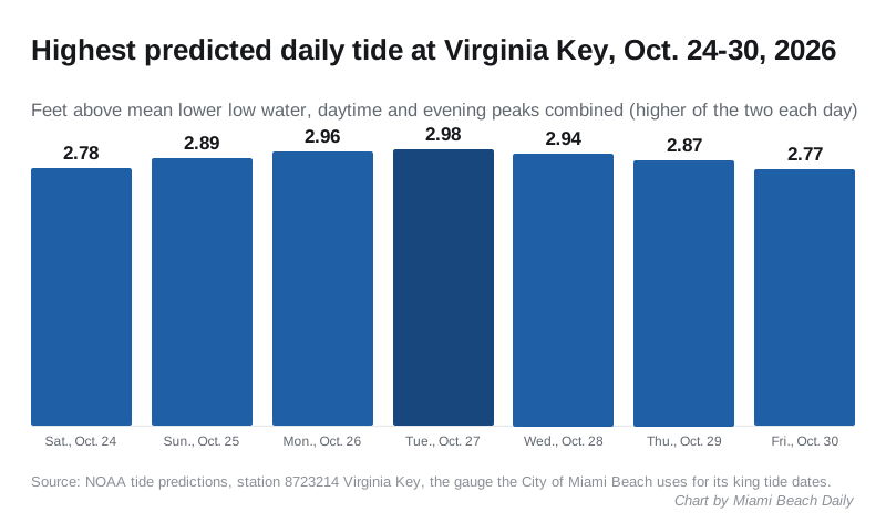
The daily highs in NOAA’s table, in feet:
- Saturday, Oct. 24: 2.78
- Sunday, Oct. 25: 2.89
- Monday, Oct. 26: 2.96
- Tuesday, Oct. 27: 2.98
- Wednesday, Oct. 28: 2.94
- Thursday, Oct. 29: 2.87
- Friday, Oct. 30: 2.77
These are astronomical predictions. They do not include rain, wind or waves, which can push water higher. For a forecast that does, the city points to the Enhanced Tidal Outlook dashboard run by the South Florida Water Management District and the University of Miami. Choose the Virginia Key gauge for the closest Miami Beach readings.
Free garage parking if your street floods
The city’s Parking Flood Relief Program lets residents on low streets park free in a city garage while a flood notice is active. You must register first, and your address must sit next to a low roadway on the city’s elevation map.
The king tides page lists three garages:
- G1, 200 7th St.
- G9, 1661 Pennsylvania Ave.
- G6, 400 W. 42nd St.
Parking is free only while the city has an active flood notification, and registered users get an email when one starts. Spaces are first come, first served. The city says it cannot promise a warning before every event. The program’s contact number is 305-673-7505.
The rest of the season
Two more king tide windows follow, according to the city:
- Friday, Nov. 6, to Monday, Nov. 9
- Monday, Nov. 23, to Thursday, Nov. 26 (Thanksgiving)
What it means for you
- Move your car before the peak if your street floods. Register for garage parking now, not on the morning of the tide.
- Do not drive through flooded streets. The city warns that a car can float in surprisingly shallow water. If your car touches salt water, wash it, including the underside.
- Stay out of floodwater. The city says it may be contaminated and can hide debris.
- Get road updates by texting MBTraffic to 888777. Some streets may close during flooding.
- Report flooding that blocks access or damages property to the Public Works control room at 305-673-7625, by email to flooding@miamibeachfl.gov or through the Miami Beach Gov app.
- Boaters should check the tide before leaving the dock, because high water lowers bridge clearance, and slow down near seawalls.
Owners of waterfront homes can apply for up to $20,000 toward raising or repairing a private seawall through the city’s seawall grant program. For closures on the island this week, see our road construction and closures page, and for storm planning, our hurricane prep guide.
Have your say